Real Estate Mapping & Demographics Software

Real estate mapping and demos with 15,000+ layers of Esri Data

Imagine an Interactive Map with:

  • Upcoming developments in the trade area
  • Future land-use plans by municipal or commercial actors
  • Other major owners active in the marketplace
  • Comparable and competitive properties for lease or sale
  • Potential acquisition opportunities, including distressed assets, based on the client’s precise definitions/criteria
  • Traffic patterns and counts
  • Future road improvements
  • Elevation and flood risks
  • Utility locations and rate structures
  • Demographic and econometric trends
  • Relevant boundaries (wetland-mitigation banking, economic incentive zones, etc.)
  • Zoning overlays
  • Filterable parcel, property and portfolio data
Legend

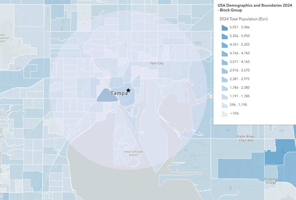
Showing population tiers.

Demographics Map

Use our software to display demographics (imported from ESRI) surrounding a property, visualized in granular detail. Concentric rings can be switched on or off.

Embedded GIS Support

Map your property accurately and effectively, without an in-house Research analyst or GIS expert.

Demographics Map

Use our software to display demographics (imported from ESRI) surrounding a property, visualized in granular detail. Concentric rings can be switched on or off.

Legend

Showing population tiers.

Embedded GIS Support
Nonstop Updates

Map your property accurately and effectively, without an in-house Research analyst or GIS expert.

We are particularly proud of the powerful results that come from combining real estate and econometric data with multi-layered, geographic information systems (GIS) mapping. These really are ‘Wow!’ moments for our private debt and direct real estate clients, especially when combined with some investment thesis-testing by our expert analyst team.

Get a Demo